Services

RV SeaFoam delivers specialized offshore services, combining advanced vessel technology, precision positioning, and expert teams to support survey, research, dive, and recovery operations. With nationwide U.S. waters coverage and rapid mobilization, we provide reliable, compliant solutions for energy, environmental, archaeology, and commercial maritime projects.
Inspection Class ROV Services
Our Outland 1500 is a versatile, inspection-class Remotely Operated Vehicle designed for precision and reliability in challenging underwater environments. Compact yet powerful, it excels in tasks such as pipeline inspections, structural surveys, and marine research. Equipped with high-definition cameras, robust lighting, and advanced maneuverability, the Outland 1500 delivers clear visuals and accurate data even in low-visibility conditions. Its lightweight design allows for rapid deployment from small vessels, making it ideal for offshore and inshore operations where efficiency and safety are paramount.

Dive Operations

Our dive operations are built on precision, safety, and efficiency. Most dives are conducted on open-circuit systems using advanced nitrox procedures, allowing for extended bottom times and reduced decompression risk. This approach maximizes productivity during underwater surveys, inspections, and salvage operations while maintaining the highest safety standards. Whether working in shallow or deeper environments, our team combines technical expertise with proven protocols to deliver reliable results for complex marine projects.


Shipwreck Survey
Our shipwreck survey services begin with advanced detection techniques to accurately locate submerged vessels before any dive operations commence. We utilize side-scan sonar and magnetometer towing to identify anomalies on the seafloor, ensuring precise positioning of potential wreck sites. Once a target is confirmed, our skilled divers conduct detailed visual inspections and documentation, supported by high-definition imaging and proven safety protocols. This integrated approach delivers thorough mapping, condition assessments, and actionable data for historical research, salvage planning, or environmental studies—all executed with efficiency and reliability


Offshore Salvage & Recovery
RV SeaFoam specializes in offshore salvage and recovery of lost items on the seafloor, including treasure, historic artifacts, cargo, equipment, and other valuables. Our operations combine manned dives, heavy-lift capabilities, and precision positioning for efficient, compliant retrieval with full documentation.


C-MAX Side-Scan Sonar
Our C-MAX CM2 EDF side scan sonar unit features the enhanced dual-frequency configuration operating at 325 kHz (for ranges up to 150 m per side) and 780 kHz (for high-resolution imaging at shorter ranges of 12.5 m, 25 m, or 37.5 m per side). This setup excels at detailed target identification: use the 325 kHz frequency to locate and survey objects over wider swaths, then switch to 780 kHz for exceptionally sharp images with lateral resolution as fine as ~18–39 mm (depending on range), making it ideal for positively identifying small or intricate features like debris, chains, or seabed textures once detected. The system supports simultaneous or selectable dual-frequency operation, digital data processing in the towfish for clean transmission, adjustable beam depression (10° or 20°), and robust performance for inshore and hydrographic surveys.


Mapping the Depths with Magnetic Accuracy.
Our Marine Magnetics SeaSPY marine magnetometer delivers exceptional performance for detecting and mapping magnetic anomalies in marine environments, utilizing advanced Overhauser sensor technology for omnidirectional, high-sensitivity total field measurements with no dead zones—ensuring reliable data regardless of towfish orientation or survey direction. It offers outstanding absolute accuracy of 0.1 nT, noise levels as low as 0.01 nT/√Hz, and negligible temperature drift.


Sonardyne Micro Ranger 2
Maximum efficiency with the best value underwater tracking system on the market
It’s built on the same tried and tested cutting-edge hardware and digital acoustic technology found in the rest of our Ranger USBL family, so you can expect unrivalled performance without the complexity or cost. Its robust and compact format is ideal for your shallow coastal water and inland waterway operations thanks to its ultra-portable design. Track your divers and autonomous underwater vehicles at up to 995 m range.


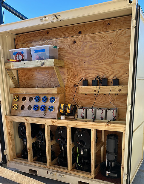
Diver Metal Detection service
Aquapulse AQ1B Compact underwater metal detectors—rugged, professional-grade pulse induction units built for reliable performance in saltwater and challenging marine environments. Each features a separate handheld search coil on an ergonomic grip/handle connected by cable to a compact, belt-mounted blue control unit, offering deep detection (up to several meters depending on conditions), full submersion to 100m
_edited.jpg)
_edited.jpg)
Offshore Chase Boats
Diver Retrieval & Chase Boat Support We deliver fast, reliable diver retrieval and safety overwatch using our agile 17' Boston Whaler for close-in pickups and our fast 20' RHIB as the offshore chase boat. This duo ensures constant tracking, rapid response to surfacing divers, and seamless support for drift dives, extended operations, or emergencies—prioritizing safety in nearshore to offshore conditions.
4-Point Mooring & Vessel Support For precise station-keeping over sensitive sites, wrecks, or structures, our team expertly handles 4-point mooring systems to minimize drift and environmental impact. We also provide full vessel support services as needed, including equipment shuttling, personnel transfer, standby safety, and integration with larger dive spreads or motherships.
2 - 2006 Yamaha WaveRunner FX 160hp (High Output) 3-4 person personal watercraft powered by a smooth 1052cc four-stroke engine. It offers strong acceleration, excellent stability.


Ocean floor blower system
The blower is our subsea propwash/“ocean floor” blower used to channel high-volume propeller wash to the seabed to displace sand and sediment and create controlled excavation holes. We use it for rapid, non‑invasive exposure of buried objects, pipelines, wrecks, and archaeological sites while minimizing environmental impact. The Blower system capable of blowing a 30ft diameter hold down to 100+ ft of water


Our Commitment to You
We stand behind the quality and reliability of every service we provide. Your satisfaction is our priority, and we strive to exceed expectations on every project—whether it’s dive operations, ROV inspections, or advanced survey work. If something isn’t right, we’ll work with you to make it right. That’s our promise.